Yunsan
윤산
About
A 317-metre hill with pine and cypress trails, a barefoot gold-clay path and views over Hoedong Reservoir.
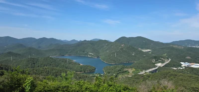
At 윤산’s summit, three different boundary stones stand side by side, an oddly satisfying photo stop after the climb. The hill rises to about 317 metres, and on a clear day the view takes in Hoedong Reservoir, Jangsan, Haeundae and Gwangalli. A pavilion and rest area give you somewhere to pause before choosing a way back down; there is also a toilet on the ridge. The paths wind through pine and cypress, with a barefoot gold-clay trail for a slower, shoes-off stretch. Along the way, look for the forest library and forest experience center, or stop at the gym-style exercise equipment if you want to turn a walk into a workout. It is a local-use mountain rather than a developed attraction: residents come for daily walks, and families, trail runners and mountain bikers share the routes. Plan on roughly one to one and a half hours for a round trip, with a loop of around four kilometres cited for one route. There are several trailheads and route options, so the walk can vary; Bugokam rock is a useful navigation point for an entrance. Roadside parking may be possible near the entrance, but check signs and local enforcement rather than assuming you can leave the car there. The summit rest area makes a natural stopping point, and the paths also suit a short outing when you do not want a strenuous hike. 윤산 works well for a low-key dose of greenery, exercise or a family walk, especially if you are happy to let the route and weather set the pace. Keep expectations measured if you are making a special trip just for a dramatic panorama: one reviewer found the view ordinary, though the reservoir makes a good focal point. In spring, the trail is also tagged as a cherry-blossom spot, but conditions will depend on the season.
Local tips
- Navigate to Bugokam to find an entrance.
- Allow about 1–1.5 hours for a roughly 4 km loop.
- Choose among the trailheads and route options to suit your pace.
- Check roadside parking signs and enforcement before leaving your car.
- Pause at the summit pavilion and compare the three boundary stones.